Eco NW - Tools & methods
Modeling, analysis, visualization and data sources
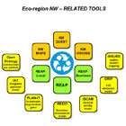
Other tools
The REAP toolkit itself is continuously under development, and is surrounded with a large set of R&D type workbooks and datasets. Some of these are from the ISCAM (Integrated sustainable cities assessment method) (Ravetz, 2000). There are many others with applications to sectors such as construction, education, waste management, transport and so on.
The Atlas NW model is a prototype of an interactive regional land-use and urban development model. This is featured in the NW Quest section of this site.
The INSURE model is a system dynamics approach under development by CURE and others, in a FP6 project funded by the European Commission - www.insure-project.net. It combines two main strands:
- A 'system model' which uses Eurostat data on economy, population, infrastructure, sectoral change and spatial development, for any NUTS 4 region in the EU
- A 'system mapping' method which involves users in a process of exploring the chains of cause and effect in policy issues, most of which cannot be modeled by numerical means
The GRIP (Greenhouse gas Regional Inventory Project) is an initiative set up by the Tyndall Centre and the Environment Agency. The project has provided a clear, consistent and transparent methodology for calculating emissions on the sub-national scale. The heart of the project is the scenario tool, which shows the relative impacts upon emissions of demand changes and fuel switches, regionally and nationally. www.grip.org.uk