Atlas NW - Introduction
Designing the future and understanding the present
How to use the NW Maps
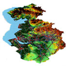
There are now many ways to get maps and satellite images on the internet, such as Google Earth. However the NW Maps shows a much wider range of thematic maps than is available anywhere else. Depending on feedback, we aim to update the maps from their current baseline year of 1995 (a major task).
To start, go to the home page:
- Select the either the NW region, or the county you are interested in
- Select the 'theme' from the list on the right hand side, and the map you want
- Select 2D or 3D view
- Select which layers: basemap, rivers, or roads
- For 3D views, select the angle of view: N, S, E, W or other
In the current version this order has to be followed. To start looking at another theme you have to go back to the home page first.
Each theme also has a range of 'other maps': these are flat maps which have been used in the Eco-quest NW model.
There are also other functions available from the home page:
- Find locations with the gazetteer (UK map icon)
- View the animations and fly-throughs (camera & aircraft icons)
- Navigate around a detailed large scale satellite image (NW map icon)
The NW Maps has been put together by the Manchester Regional Research Laboratory, with digital data supplied by CURE.